


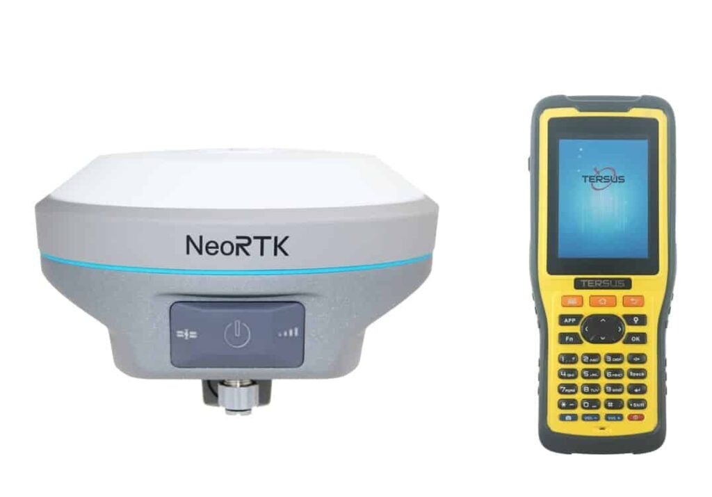
Tersus GNSS, a manufacturer of high precision GNSS RTK boards, receivers and systems, has announced the company’s latest GNSS RTK System, the NeoRTK. The NeoRTK system is built around a multi-constellation and multi-frequency GNSS board that is able to provide accurate and stable signal reception and is designed for land survey and drone-related surveying uses. The built-in battery allows operation for up to 10 hours, enabling surveyors to operate for longer in the field. The Rover package also comes with a handheld PDA to maximize ease of use.
The NeoRTK supports 16G internal storage and features an expandable 32G external SD card. The system is IP67-rated and meets standards for protection against dust, water, drops and temperatures. The handheld PDA in the package has a 3.7-inch sunlight readable screen. This compact PDA features a powerful processor and alphanumerical keypad, and an adjustable measurement rod with automatic tilt compensation ensures efficiency in the working process.
“The professional applications of NeoRTK are various,” says Xiaohua Wen, founder and CEO of Tersus. “In addition to surveying and mapping, this NeoRTK can be used in construction engineering, utility, transportation, GIS data collection and can also be an ideal choice for reference station establishment.”


