


Unmanned Systems Source has released an article designed to help surveyors decide when to use photogrammetry or LiDAR (Light Detection and Ranging) for surveying and mapping via drone.
Choosing between photogrammetry and LiDAR is not a case of which offers superior technology but, rather, which is better suited for the surveying purposes required. Unmanned Systems Source has outlined some key considerations below.
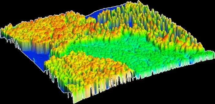
Photogrammetry uses pictures to take measurements whereas LiDAR uses lasers and light to do the same. For mapping and surveying bare earth regions, photogrammetry is a great choice. But for areas with heavy vegetation or other obstructions in the way of the site being surveyed, LiDAR provides the best fit.
Drone technology has made a huge impact on aerial mapping and surveying. Drones offer many advantages including the ability to capture photos at predefined elevations and at a predetermined overlap percentage.
In the past, conventional aerial LiDAR providers turned down surveying projects on areas under 5 square kilometers because it simply wasn’t cost effective. Today, drones mounted with LiDAR systems can map these same areas quickly, affordably and with far less logistical issues.
In turn, while drone-mounted LiDAR systems achieve great results, the disadvantages lie in the cost and the infeasibility of using them over larger areas.
UAV LiDAR systems also offer image control and perspectives unique from traditional capture methods. Drone operators also have the flexibility to configure the vehicles to gather large volumes of data and capture images that are perfect for what the application requires.
The affordability of drones also means that aerial surveying and mapping has attracted more people to the industry. This translates into varying skill and experience levels which inevitably brings about mixed surveying results. In the same way, organizations that rely on surveying data have also decided on an in-house approach.
Regardless of whether a surveyor chooses photogrammetry or LiDAR, the ultimate goal is to acquire accurate imagery. Surveyors begin by determining the level of accuracy they require, which drives the decision between LiDAR and photogrammetry.
Generally, LiDAR achieves more accurate results but is limited when it comes to obtaining high-resolution images through the technology’s data. Often, individual use traditional photogrammetry methods to augment the LiDAR data.
Surveyors often choose what they are more familiar with, as well as what is more affordable. While there is nothing wrong with such an approach, it is important to keep in mind that the requirements of each project will vary, as will their cost.
The use of UAV LiDAR or photogrammetry alone may work for one project while other missions may require the use of both technologies to achieve the desired imagery. Some surveyors forego LiDAR and photogrammetry entirely, instead choosing photo-based solutions. Though initial costs may be more affordable, redoing everything means expenses can mount quickly.
Currently, LiDAR is not as readily available in mainstream technology but options continue to increase. With the right drone and a camera of reasonable quality, surveyors can achieve workable measurements.
If a project’s requirements are accurately followed, photogrammetry produces accurate 3D models. Its low cost also means that it is the most common choice for surveying. Today, even inexperienced operators can capture images to create a 3D demo. However, the quality of the work determines the quality of the data.
When considering LiDAR or photogrammetry, it is important to remember that the choice is not about which is better. Both offer advantages and disadvantages. Limitations presented by technology capabilities, terrain, as well as the size of the area all come into play.
Given the choice most surveyors would happily choose both technologies to utilize as they see fit. Those interested in surveying via drone should learn as much as they can about both technologies to determine which works best for their situation.
The team at Unmanned Systems Source are on hand to answer any questions you may have and have detailed knowledge of a range of aerial mapping solutions.


