


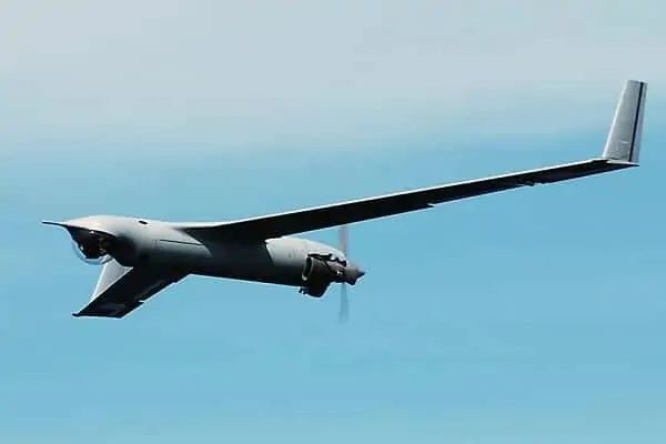
 Insitu, a designer and manufacturer of unmanned aircraft systems (UAS), has announced that it will incorporate the ViDAR (Visual Detection and Ranging) payload into its fleet of unmanned systems, beginning with its ScanEagle unmanned aircraft. ViDAR is a wide area autonomous detection system for electro-optic imagery in the maritime domain. In addition to cueing ScanEagle’s primary camera turret, the payload gives operators who typically must rely on larger, more expensive aircraft to detect objects in the ocean a smaller, more cost-effective solution.
The software that runs the ViDAR payload was developed in Australia by Sentient Vision Systems, a developer of computer vision software solutions, and was built into a ScanEagle payload by engineering firm Hood Technologies. Sentient and Insitu have confirmed the signing of an exclusive global distribution agreement for the ViDAR software for unmanned systems within the small UAS weight class.
“For two decades, Insitu has been at the forefront of customer-inspired innovation,” said Don Williamson, Insitu’s vice president of the ScanEagle product line. “Adding ViDAR’s capability to ScanEagle demonstrates our focus on continuing to deliver mission-critical technology for our global customer’s maritime ISR needs.”
“Insitu, Hood Technologies and Sentient have collaborated to bring this capability to airborne maritime operators,” said Simon Olsen, Sentient’s Director of Business Development, Strategy and Partnerships. “The experience Insitu brings to tactical maritime UAS operations makes them the perfect partner to help provide a better solution to airborne maritime customers.”
ViDAR fits a modular slice on ScanEagle that comprises a large backplane digital video camera that continuously scans the ocean in a 180-degree arc in front of the air vehicle. Sentient’s ViDAR software then autonomously detects any object on the surface of the ocean, providing the ground control station with an image and location coordinate of each object detected in real time. The primary sensor can then be cross-cued to the object by simply clicking on the image. In demonstrations, ViDAR has autonomously detected a fishing vessel at 14 nm, a fast boat at more than 9 nm and even the spout of a whale at 1.5 nm from the aircraft.


