


 Auburn University has announced that its precision agriculture researchers are using unmanned aircraft systems (UAS) to monitor crop health over large acreages, utilizing the aircraft to develop a method that lets farmers quickly address potential trouble spots.
“Precision agriculture techniques enable the producer to apply things like fertilizer and herbicide only where they are needed, which helps increase yields and profits for agribusiness,” said Steve Taylor, head of Auburn’s Department of Biosystems Engineering. “These tools are having a major impact in many areas, not only for agricultural crops but also for better management of our forests.”
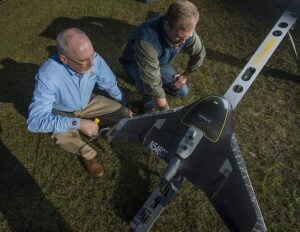
The unmanned aircraft systems, or drones, are programmed to fly over a specific agricultural area and capture digital images and data with various types of cameras or sensors. After the flight, researchers download the data onto a computer so they can see potential trouble spots, such as moisture stress in plants, diseases that might be developing or a nutrition issue. The data is transferred into GPS-guided ground equipment that can deliver resources—water, pesticides and fertilizer—precisely where they are needed.
“It’s a platform to carry a sensor to let us collect information much more rapidly,” Taylor said. “The farmer or another UAS provider can come to the field today and collect information, download it to the computer this afternoon and have that data. Within a few hours, we can be back in the field taking action to remedy the problems uncovered by the UAS.”
Auburn is conducting much of its research at E.V. Smith Research Center near Tallassee and at other Auburn research stations across the state and for individual farmers.
Research engineer Christian Brodbeck says the Department of Biosystems Engineering works closely with the university’s Aviation Center to obtain FAA authorization to fly in specific areas and at certain altitudes.
Auburn’s Aviation Center has FAA authorization to fly anywhere in the state below 200 feet for education and data collection activities. Biosystems Engineering recently received a Certificate of Authorization, or COA, from the FAA to allow detailed research flights at the E.V. Smith Research Center at altitudes up to 400 feet high.
“This higher altitude allows us to cover more ground during a flight or reduces our flight time for a given field,” Brodbeck said. “We have applied for another COA to fly anywhere in the state at these altitudes to expand our research capabilities.”
He says Auburn’s fixed-wing drones have extended flight times, in varying wind conditions, while their rotary-wing drones can fly about 15 minutes. The cost of research drones is substantially higher than hobby models, ranging from $30,000 to $50,000, but as with most electronic equipment, the price is expected to go down. The advantage of the professional models is the advanced software, longer flight times and more powerful cameras and sensors, according to Brodbeck.
Greg Pate, director of E.V. Smith Research Center, added, “If we have the data quickly back from processing then we can make adjustments to the crop as we need to. We can get the right product at the right rate in the right place at the right time. And time is critical.”
SOURCE: Auburn University Newsroom


